Four years ago I did the Tour de Mont Blanc, 167km, 12,500m ascent, with Shane and Heather Ohly. Similar to the UTMB non-stop race, but we took it at a more leisurely running pace, spread over four days, staying in mountain huts. A wonderful experience, great views and trails, but also very popular for walkers / tourists, and busy in the huts and on the trails. You can read about it here. This summer Shane and I had a free week, looking for some mountain adventure (OMM training?), and thoughts turned to other similar challenges…
Perhaps the next most obvious circuit in the Alps is the Tour Monte Rosa. This encircles the Monte Rosa massif, going through Switzerland and Italy, taking in the Theodul pass (3295m) and Monte Moro Pass (2853m), with some spectacular mountain side trails like the Europaweg, and stunning views including passing close to the Matterhorn.
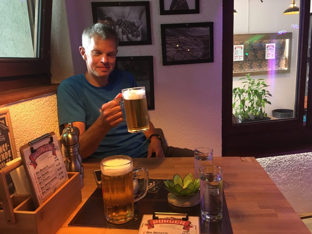
Logistics – Flew into Geneva, arriving late so stayed one night in airport hotel, then train from Geneva airport to Visp, change to mountain railway train to St. Niklaus (continues to Zermatt), then post bus up the hill to Grächen where we stayed the night either side of doing the TMR. Tip: get the SBB (Swiss trains) app for iPhone or Android which makes buying tickets easy. The cheapest super saver tickets (half price) are for a specific train and you seem to need to buy at least ~2 hours in advance. And you can’t get super saver tickets on the post bus, so buy that bit separately.
We debated how many days to take over it. We’d seen a blog from Jez Bragg who whizzed round in 3 days, travelling ultra light, and he is fit! We thought about 4 days, same as we did the TMB. But then Shane spoke to some people who had done it before, got some tips on huts to stay in (in particular those in the high passes), and we eventually settled on 5 days. Here they are:
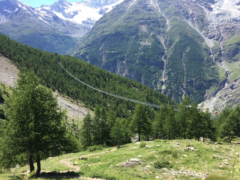
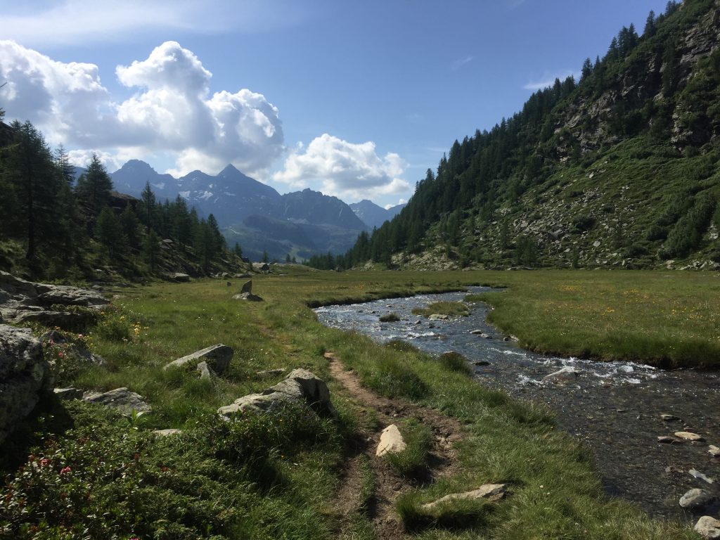
Day 1, Grächen to Europaweghütte, 28.6km, 2334m – Follows the superb Europaweg which in places is a narrow path clinging to the side of steep mountainsides, in other places a pleasant trail through the trees. Unfortunately there has been a recent rockfall / landslide on the Europaweg between Grächen and the Europa hut, so you currently have to take a detour down the hill then a punishing climb 1000m straight back up again (and speaking to some locals they thought it unlikely this would be repaired for years). Oh well, it was the first day and we were still strong, so didn’t mind too much. Mainly a shame because the bits of Europaweg we still did were nice, and we probably missed even better bits. We stopped for lunch at the Europa hut (which is confusingly different to our final destination of the Europaweg hut), and soon after went over the Charles Kuonen Suspension Bridge, the longest pedestrian suspension bridge in the world (494m).
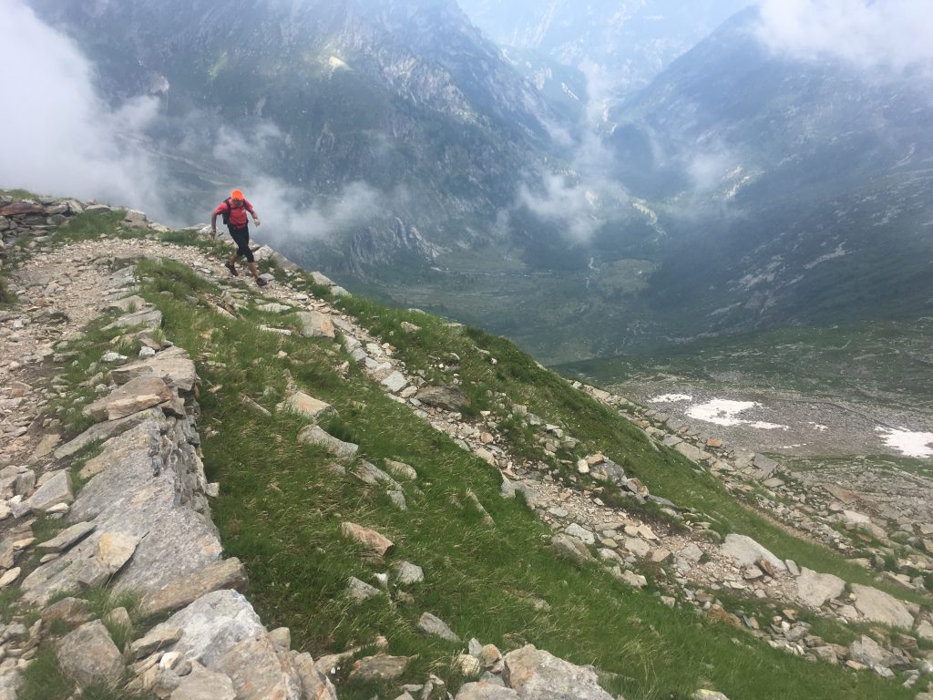
Day 2, Europaweghütte to Theodul Pass, 30.2km, 2691m – We were going to take the shortest route, down into Zermatt then a long trek up to the pass. However, chatting to some others in the hut, they said they were going up the valley from the hut to the Pfulwe Pass, and down to Zermatt from there. It was still only day 2, we were fresh, and never ones to turn down a challenge, so it was pretty quickly established that we were going that way as well! A great choice, a nice start to the day up the quiet Täschalp valley, a brief climb to the pass, and then some great trails from there down to Zermatt, only spoilt by getting increasingly busy with tourists / walkers (not getting in the way, just lots of them). Coffee and a bite to eat in a small café in Winkelmatten, which is the south end of Zermatt we came into, and avoids the circus of the town centre. Then it was heads down for a 1700m climb up to the pass and the hut. Mostly it was ok, and some great views. The last 2-3km is up a ski piste under a ski tow – on an glacier, but uncrevassed and safe enough, just slushy in the afternoon warmth and a bit of a slog. Fortunately our hut was hidden in the pass, and not the one that looked about a mile further up the slopes!
Day 3, Theodul Pass to Rifugio Gabiet, 30.2km, 1433m – You start in the shadow of the Matterhorn (taking the stunning view for granted by now…), and descend through what is a ski area in winter, but in summer looks like an industrial wasteland, with piles of rocks / moraine, and building works for more ski infrastructure. However, after 5km you pass that and you are into glorious flowing trails down green valleys, and not a soul in sight. Coffee at the Rifugio Ferraro, before a stiff climb up to the Bettaforca Col, down to Stafal for some lunch, and up a nice valley to the hut.
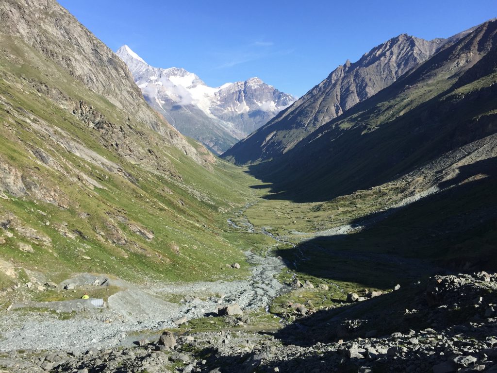
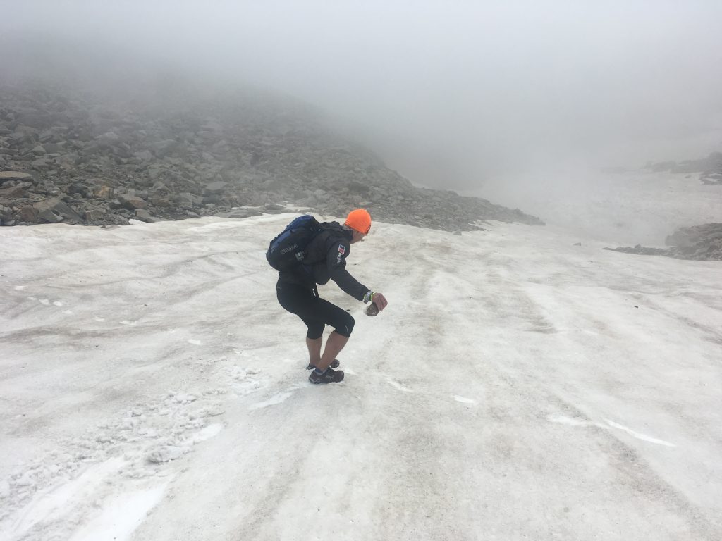
Day 4, Rifugio Gabiet to Monte Moro Pass, 43.9km, 3727m – We knew this was our big day, culminating in a big climb up to the hut. Pleasant start up to the ski station. Then the regular TMR trail goes south east, down to Alagna Valsesia, but being orienteers / fell runners with a streak of alpinism in us, we spied what looked like a shorter trail on the map and with less ascent. It initially went north, over the Stollenberg, then descend to the valley – simple right?! Erm no. Initial confusion near the lifts, trying to follow groups of mountaineers with full alpine gear, crampons, ice axes (we have shorts, fell shoes, and walking poles). Reverse, and get onto the crest of the ridge. Some snow patches, but there are foot prints, and paint on the rocks so we are fine. Then the map shows a fork in the trail, but the way we want has no prints, no paint, and jumps off a large cliff to rocks and snow below. Definitely in the right place. Is the map wrong? Who knows. After wasting lots of time deliberating and searching, we continued up the ridge (which ultimately heads up the 4600m Monte Rosa…), past some ruined bivouac shelters, keep peering over the cliffs but no sign of passage, eventually reaching a long since defunct ski lift station at Punta Indren (oddly the diesel generator is still running despite no signs of life?). Finally just beyond a ski passage leads down through the band of cliffs (an off piste run in winter I guess). What follows is some amusing glissading on our fell shoes down steepish snow patches. Shane just went for it, I took a more cautious approach, with a sharp rock in hand to use as an impromptu ice axe if necessary, but eventually got the hang of it, and it was much easier than rock hopping to the side of the snow, and only mildly more dangerous! Finally the snow ends, and we have a another pleasant valley to descend, a picturesque lake and a stream, feels like we could be on an MM in the Scottish Highlands, ending at the Rifugio Pastore for coffee (and a large slice of cake!). Whew, 3 hours done, not actually gone that far, and we still have a long way to go today! The next section is a joy, over the Turlo Pass, which has a magnificently constructed path built by the Walser people centuries ago, winding its way up and back down the other side. We are tiring by the time we reach Macugnaga, in the valley heat of the day, and not helped by a mile diversion because a bridge on our map is washed away. Bowls of spaghetti refuel our spirits in a café, next to the lift tempting us the easy way up to Monte Moro Pass. But stomachs sated we press on up the long climb to the hut.
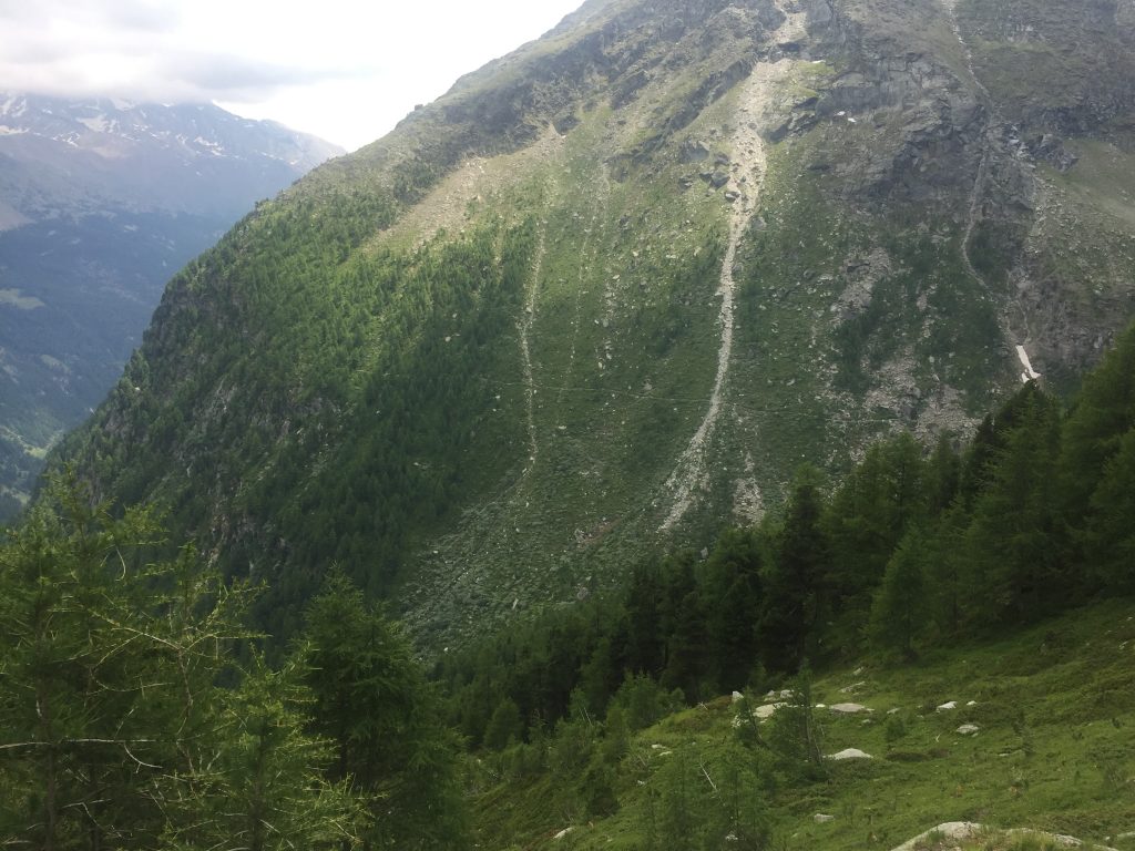
Day 5, Monte Moro Pass to Grächen, 38.7km, 1713m – We are greeted with a misty morning, and waste 20 minutes trying to find the col and path down the other side which is only 200m away. Eventually we are on it and skipping our way down to Saas-Fee. A grim ski resort town in summer, only posh hotels and restaurants, no café for grubby runners with 5 day old smelly clothes on. We settle in a café, my stomach is filled with watery soup and copious amounts of coke (I didn’t think the “large” bottle would be that large), and wallets are emptied of swiss francs. However soon that is behind us, and we are on the marvellous Höheweg trail back to Grächen. This is another of those that after an initial climb it doesn’t go up or down that much, but clings to the mountainside in some spectacular situations, under rock bands, through the odd tunnel, across boulder slopes, and round valleys. Despite 5 days of running the excitement lifts us as we skip along the trail with delight. Finally the end comes, a quad aching plod down the final slope and we are back in Grächen town square… to be greeted a slightly surreal hubbub of the Junior World Fly Casting Championships taking place. Job done.
Total 172km, 11,900m ascent. The huts we stayed in:
- Europaweghütte – Pleasant hut in the peaceful Täschalp valley. Showers (6 CHF) and tap drinking water. No phone signal, WiFi or power sockets. Large platform style hut bunks that could fit 14 (would feel very cramped), but only 5 people staying in our room. Swiss (CHF). Not to be confused with the Europahütte which is another hut further north by the suspensions bridge that we passed earlier in the day.
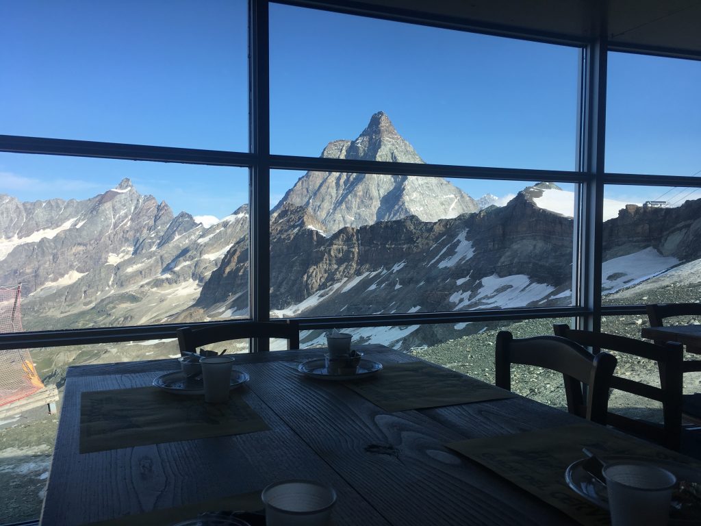
- Rifugio Teodulo – Perched in the Theodul pass, with simply spectacular views of the Matterhorn out of the huge window down one side of the modern dining room. Power sockets, phone signal, WiFi. No showers or tap drinking water. Bunk beds, 8 beds in our room (only 6 occupied). Just on the Italian side of the border (euros).
- Rifugio Gabiet – Another peaceful spot halfway up what is a ski resort in winter. Showers (free), power, phone, tap drinking water. No WiFi. Small occupancy rooms – just 2 beds in ours. Really nice feel to the hut and good facilities. Italian (euros).
- Rifugio Oberto Maroli – Top of the Monte Moro pass, with views of Monte Rosa. Unfortunately it was a bit cloudy when we were there, but the views of the summit came and went. Showers (€3), power, WiFi. No phone signal or tap drinking water. Bunk beds, 6 beds in our room (only us in there). Just on the Italian side of the border (euros).
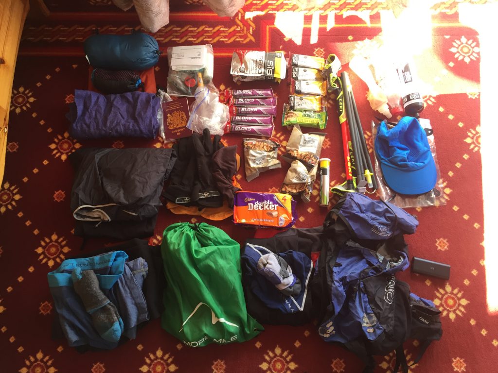
Kit – My kit list below, 5kg bag to start, nearer 3.5kg at the end after eating food. Walking poles were a godsend, I didn’t have them on TMB and really appreciated them on the climbs here. I rarely carried more than 400ml liquid, filling up in mountain streams, or fountains in the villages. The map was the 1:50,000 5028T Monte Rosa / Matterhorn Swisstopo map which – combined with way marking – was largely adequate (apart from our wanderings off-piste mentioned earlier, but they just add to the fun). Showers are very welcome in those huts that provide them. Your single set of clothes smell by the end, but you get used to it.
| What | Contents | Weight (g) |
| Shoes | X-talon 200 red | 590 |
| Walking poles | Leki Micro Trail Race | 360 |
| Running kit | 3/4 tights, t-shirt, pants, socks | 387 |
| Pack | OMM 20l sack | 445 |
| Spare clothes | Stuff sack, furry leggings, short and long-sleeve thermals, pants, socks, hat, gloves, cap | 883 |
| Water bottles | 2x 500ml | 82 |
| Waterproofs | Lightweight top and bottoms | 280 |
| Food | 4 Rego, 3 roasted cashews, 4 double decker, 4 snickers, 7 SIS Go bars, 3 other bars, 5 shot blocs, 1 tube electrolyte tablets | 1924 |
| Other | Short sleeved down jacket, silk sleeping bag liner, pack towel, bags | 514 |
| Electrics | iPhone, Garmin 235, battery pack, charging cables | 413 |
| First aid etc | Survival bag, bandage, plasters, compeed, tissues, contact lens, ear plugs, paracetamol, nurofen, lipsalve, headtorch, toothbrush, compass, shampoo, money, BMC and EHIC cards, passport, wallet | 488 |
| Map and bag | 5028T swisstopo | 155 |
| Pack weight | 5184 | |
| Total weight | 6521 |
The real highlights of the trails for me were:
- passage through the Pfulwe Pass and run down to Zermatt
- views of the Matterhorn from the Theodul Pass hut
- valley trails down the Italian side of the Theodul Pass
- our off-piste adventure on day 4
- path up and over the Turlo Pass
- final trail from Saas-Fee to Grächen.
So how does it compare to the Tour de Mont Blanc? One downside is in several places on the TMR you are trekking up beside ski lifts, and ski infrastructure is all around you (although there are exceptions like the Turlo Pass), whereas there is much less of that on the TMB. But perhaps the standout thing in favour of the TMR was the lack of people. On the TMB, the huts were rammed, I’d say 90% of people were walking the trail in guided parties, and the first hour or two each day consists of passing all those who set off straight after breakfast. On the TMR we hardly saw anyone who seemed to be doing the whole trail, and none of the huts had more than a dozen people in (our last hut just had us and three other guests). In places it is a wild mountain experience, and some of the trails are just pure joy. I’d recommend it to anyone seeking a running adventure.